10: 06 am, 14-07-2012
Without any surprise (due to my lack of training) I just made my best performance to date on my MTBike!
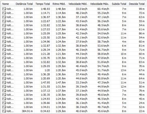
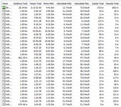
I just beet my previews speed record (on a descent – of course) from 73 kph (3 years ago in Austria) to a hopping 83 kph just next my home place! During this time of the year, because of the Tour de france, I remember I have a bike and take it to the road… This year, the debut was today!
For those who think that this speed is not that much I can tell you that though I usually exit my garage with my motorcicle at higher speeds (LOL) this peed on a montain bike with slick tires seems close enough to MACH 1. In fact, now that I think about it, if someone would shout something at me, at that particular time, I’m pretty sure I would not ear it… Yep, I can see now that my true speed must have been over MACH1 during those few (very long seconds)! The GPS speed could not be that low! 🙂
Facing some head wind during the first part of the 34km course, the average speed was just over 20 kph. As the biking season progresses, I hope my maximum speeds will decrease and my average speeds move on the opposite direction. 😉
Here’s the GPS summary:
Happy and fast bike climbs!
Cheers
R.
06: 57 am, 30-08-2009
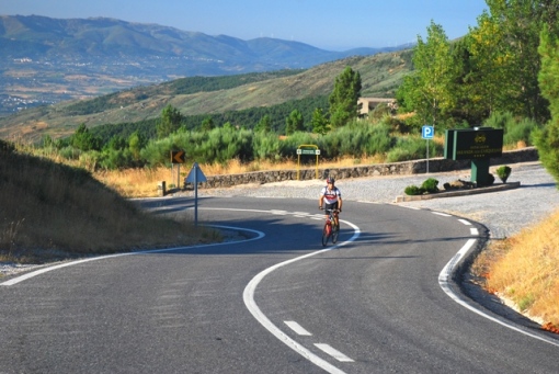
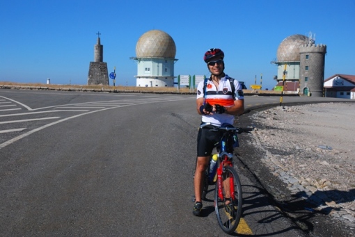
Climb: Torre, Serra da Estrela (1.993m), the highest paved road in continental Portugal.
Covilhã (at the very bottom), 463m – Torre, Serra da Estrela, 1.993m
[1,530m – 24,7 km – 6,2%]
Distance & Time: 49,63 Km – 2:54h
Time going up /down (only climb): 2:18h – 38m
Average speed up /down: 10,74 km/h – 39,36Km/h
Max. speed (GPS) and Max. gradient over 1k: 65,3 Km/h – 10%
Conditions: Sun exposure
Pace: Normal / Fast
(Options: lowest/low/normal/fast/top)
Description
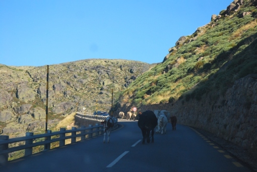
Starts steep but the difficulty is not very sustained throught the ride. After a hard/steep climb there’s a not so hard section. The hardest section is from Covilhã up to Penhas da Saude. After that, the great scenary and the fresher air make the climbing task easier. Watch out for cow and bulls (especially in the way down)!! Very dangerous to find them after a blind corner!!
Notes
In August it is wise to leave early. The most beautiful part of this climb is after Penhas da Saude. For a more scenary ride start in Valhelhas (Manteigas).
Links
http://www.climbbybike.com/climb.asp?Col=Torre&qryMountainID=7248#profile
Map & Photos
…going up (GPS data)
…going down (GPS data)
Photos by Cristiana Matos
—————————————————————————————————–
08: 15 am, 15-08-2009
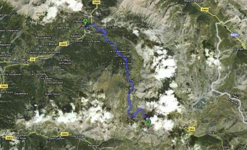
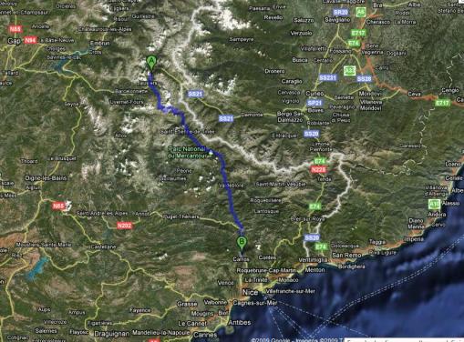
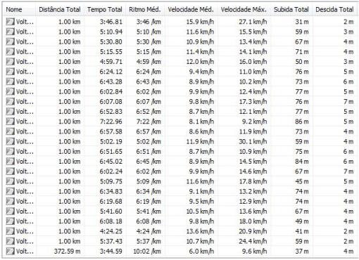
Climb: Cime de la Bonette (2.802m), According to the French it’s the highest paved road in Europe, according to the rest of the world it’s the highest paved road in France.
Jausiers, 1.213m – Cime de la Bonette, 2.802m
[1,589m – 22 km – 6,6%]
Distance & Time: 118 Km – 5:26h
Time going up /down (only climb): 2:14h – 38m
Average speed up /down: 9,85 km/h – 39,47Km/h (22Km & 25Km, respectively)
Max. speed (GPS) and Max. gradient over 1k: 60,4 Km/h –9,6%
Conditions: Very good to climb (no wind no direct sun exposure – just perfect) but awful to descend after Saint-Étienne-de-Tinée (lots of headwind)
Pace: Sustainable to be able to complete 120km
Description
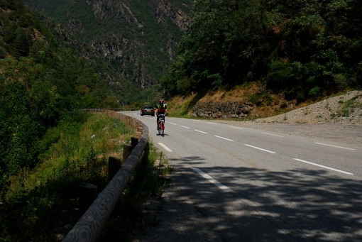
Left the camping site 1 hour later than predicted but still with good temperature for the ride. My backup car left 2 hours after. The idea was to go as far as Nice (140Km) but to guarantee that meeting wouldn’t be a problem we agreed to make the finish line 20Km before. After a 7Km warm up, from the camping site (north of Jausiers) to Jausiers, the climb would start. This climb has no major technical difficulties to talk about, though I’m not saying it isn’t hard. In fact, after the Oetztaler Gletscherstrasse (and its sun exposure), it was the second hardest. It was the most time consuming (2:14h) and the highest climb (1,6Km vertical ascent). It’s just that is all about resistance, with no particular hard crux. Unlike Monte Zoncolan, that has one kilometer of almost 20% average gradient, the maximum average gradient of this climb, over one kilometer, is 10%. Nevertheless, it was far from boring! This climb was probably the most scenery of them all. Not so much because of any particular point of the course, but rather because, as you climb, the landscape unfolds and keeps on changing as the kilometers go by, for the delight of your eyes. This makes you forget about the monotonous steadiness of the climb and makes you just want to keep one going to see what comes next. The other cyclists were very friendly, especially the ones that overtook me (2#), the overtooked ones (2#) also, but with the expected yellow smile. Near the finish, at the Col de Restefond, a photographer took me some photos that you can check below, after which came his business card (to sell them later).
The descent was done going down through the other side of the mountain, direction Saint-Étienne-de-Tinée / Nice! I thought I was going pretty fast but as I checked for approaching cars /motorbikes coming from behind I saw a cyclist looking to overtake me! Brakes on, and…“please do”! Feeling encouraged for my quick recognition of inferiority, the guy almost crashed into a car while making the next turn. Jesus! After that, I said to myself: “it is better that at least one of us lives to tell the story”. After Saint-Étienne-de-Tinée, the ride went on to finish at Saint Martin-du-Var (just before Nice). This was supposed to be a relaxed ride because it was always slightly descending, but this was not the case. The constant valley, through which the road developed, concentrated a headwind that required a constant pedaling in order not to stop (it didn’t look like a descent). My backup car only caught me at the 80th Km, distance where I got my first photo. At the finish line, and under heavy sun exposure, strong wind and empty stocks of food and water… There is only one word to describe my feelings: Exhausted!
Notes
Next time I will do this ascent from Saint-Étienne-de-Tinée. This side looks to be a harder mental challenge, because you can almost see the top from the very beginning, and the scenery part doesn’t help (either you look to the asphalt or you look to the same picture over and over again). After I finish my ride a really crazy idea just crossed my mind. How about doing the same ride that I had just completed on the opposite direction (Nice – Jausiers, 140Km and a gradient of 2,8 Km, of which 1,6Km at the end)!! If you do this you will have my eternal respect. Go luck!
Links
http://www.climbbybike.com/climb.asp?Col=Col-de-la-Bonette&qryMountainID=6062
http://en.wikipedia.org/wiki/Col_de_la_Bonette
http://www.youtube.com/watch?v=Cc1ogGEMRqI&feature=related
http://www.youtube.com/watch?v=cWMO39xJ5K0&feature=related
http://www.youtube.com/watch?v=v6ukTXr0CjA&feature=related
Map & Photos
…the climb
… the ride
… going up (GPS data)
… going down (GPS data)
Photos by a French Photographer:
http://www.photaltitude.com/photolists.php?products_page=5&category_id=66&photoTime=10h-11h&pas=12
http://www.photaltitude.com/photolists.php?products_page=6&category_id=66&photoTime=10h-11h&pas=12
Photos by Cristiana Matos:
—————————————————————————————————-
09: 50 am, 10-08-2009
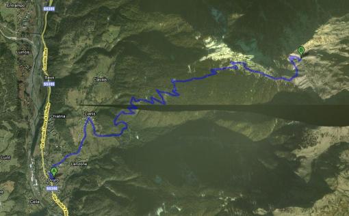
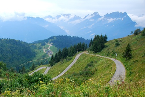
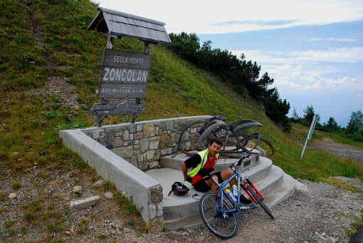
Climb: Monte Zoncolan (1.735m), one of the steepest paved road climbs in Europe.
Ovaro, 525m – Monte Zoncolan, 1.735m
[1,210m – 10,50 km – 11,5%]
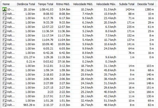
Distance & Time: 20,10 Km – 1:58h
Time going up /down (only climb): 1:35 – 0:23
Average speed up /down: 6,38 km/h – 26,35Km/h
Max. speed (GPS) and Max. gradient over 1k: 51,5 Km/h – 19,5%
Conditions: No wind, no direct sun but stuffy
Pace: Below my potential pace going up and very cautious going down
Description
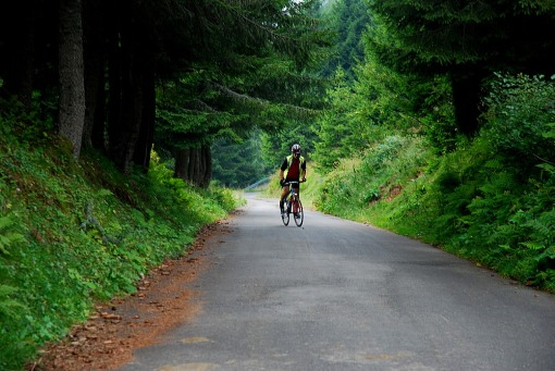
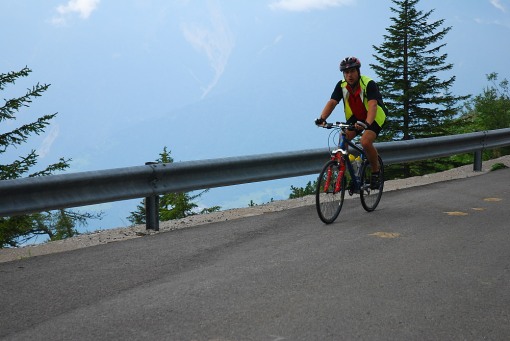
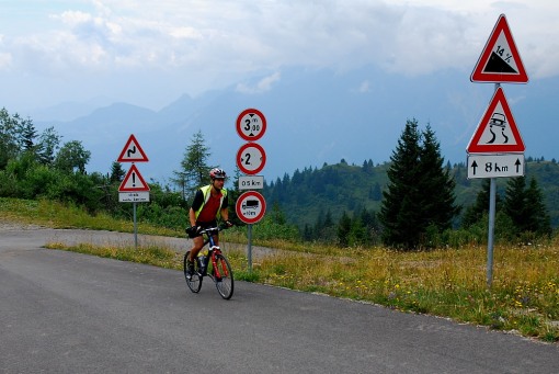
Starting from Ovaro the beginning is already steep, around 10% gradient, and as I smile for the first photo my photographer (my wife) says: “ouch!” to which I reply: “this is only the harm up!” (I had seen previously the climb profile on the Internet). This climb develops through a narrow road that crosses a dense forest. The first 1,5 km are in a “warm up” average gradient of 8%, passing by some houses and reaching the village of Liariis after which you have a 500m of rest. After the warm up… “Welcome to the jungle” (Remember Guns n Roses?). The next 6 km you have 15% of average gradient! During this distance the road is always so similar that if it wasn’t for the signs with some of the greatest cyclists of all times (Eddy Merckx, Marco Pantani, etc), that appear now and then, the déjà vu feeling could begin to affect your mind (something like: “I could swear that I had already done this one”). Because I was doing this climb with a MTB I was able to go more or less halfway on the saddle (in my lightest gear) and the other half standing. The lightest gear felt, for the first time, very heavy and, immediately, I thought about the ones climbing this hill on a two chain ring road bike – Ouch! The final 2 km have again almost a “relaxing” gradient of 8% and start to give the rider some view about the climb behind. The beautiful scenery, the lower difficulty and the top on sight gave me a final boost that curiously enough, as I cross the finish line, presents me the thought: “I could do it two times in a row”. The truth is that I was expecting even worst, something like 10 km of the hardest climbs I had already done (around 30% for no more than 100m). I did it at “comfortable” pace because I was always expecting the worst and that never came. I have to say that with a MTB at this pace this climb is OK. A possible climbing metaphor could be when you look on a climbing guide for an 8a to try on sight and you make a mistake and get yourself into a 7b+. In the end it will be very hard for you to say how hard this route really was, because you were always expecting the hard part… Nevertheless, I can’t really say it is easy. How can I explain how steep is a 15% gradient over 6 km? Maybe telling you that my wife didn’t want to bring the car down and really insisted that I would put the bike inside the car and drive us down. She was afraid of going back!
The descent was done going back and it was done very cautiously! Three seconds without using the brakes (resting my fingers) meant increasing the speed by 20km/h. It was dangerous enough for me to think that if I lost any of the brakes I would have been in deep trouble (surely wouldn’t be able to make the next turn). Still I’ve finished at Ovaro 2/3 min before the car that came down most of the way in 1st gear!!
Notes
It would have made all the difference if I didn’t have my lightest gear and if I had done some kilometers before.
Links
http://www.climbbybike.com/climb.asp?Col=Monte-Zoncolan&qryMountainID=36
http://www.altimetrias.net/aspbk/verPuertoW.asp?id=7
http://opintainho.blogspot.com/2006/12/monte-zoncolan-vertente-de-ovaro.html
http://magliarosa.wordpress.com/2008/03/02/monte-zoncolan/
http://en.wikipedia.org/wiki/Monte_Zoncolan
http://www.youtube.com/watch?v=mfbyX-78SIo
http://www.youtube.com/watch?v=8ajeAr5Zk1c
Map & Photos
Photos captured by Cristiana Matos
————————————————————————————————
12:05 am, 6-08-2009
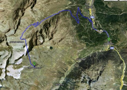
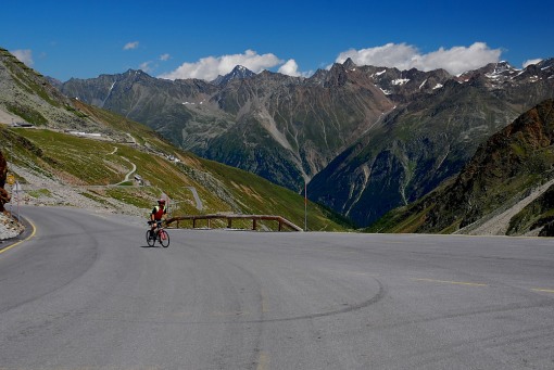
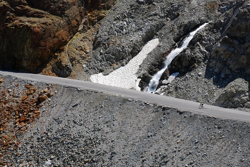
Climb: Oetztaler Gletscherstrasse (2.822m), the highest paved road in the Alps, the 2nd highest in Europe and the highest road tunnel in Europe.
Zwieselstein, 1.434m – Tiefenbach Tunnel, 2.822m
[1,388m – 14,33 km – 9,7%]
Distance & Time: 31,80 Km – 2:30h
Time going up /down (only climb): 1:55 – 0:20
Average speed up /down: 7,5 km/h – 43,0Km/h
Max. speed (GPS) and Max. gradient over 1k: 73,8 Km/h – 13,3%
Conditions: No wind but very hot and sun exposure
Pace: Sustainable pace going up and nearly insane going down
Description
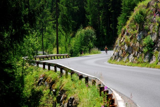
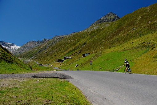
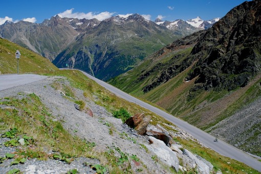
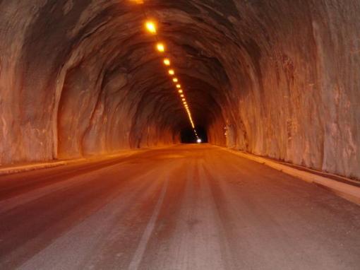
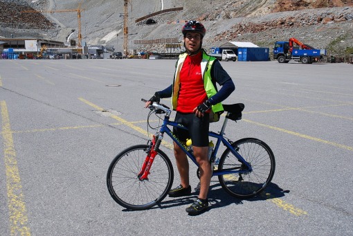
I have started this climb from Zwieselstein (1.463m) and after 2 km of warm up I reach a crossroad with one way going to Tiefenbachgletscher and Rettenbachgletscher and the other to Sölden. No mistake possible, even if I didn’t know that the goal was the Tiefenbachgletscher ski station, the road profile of the left exit didn’t lie, there the climb would begin. 2 Km after and I was already shouting “very hard” to my priceless camera woman. The sun exposure and the gradient were taking its toll and I was already asking myself if I could finish this one. No other cyclists could be seen and slowly (between 6 and 7 km/h), corner after corner, the dense forest would only unveil more climbing asphalt. After the 7th km of the ride (and the 5th Km of the climb) finally some rest. A 500m descent would lead my backup car to a €16 toll (bikers don’t pay) and the next 800m of gradient to climb. These next 6,5 km of the climb were of a different type. Great scenery and with the goal almost on sight (from there you can already see where the Tiefenbach tunnel starts – at 2.675m altitude). At that stage of the ride I was able to overtake another biker (around 50 years hold) that was even slower than me (not by much though). When I was on his side I said: “Hard!?” to which he replied “No, it’s ok”. And I thought: “Ok?? Ok it’s at home watching TV on the couch!”. At 2.643m of altitude a cross road gives access to the Tiefenbach tunnel and there it appears the second rest of the climb, a short descent of 200m that I tried to do has fast as I could (not because of a best time purpose but to be able to gain some balance and to start pedaling later into the final climb). Finally, the tunnel that would finish at this ride goal, 2.822m of altitude. I knew that this ride would cross a tunnel but had no idea of how long and steep it would be. In fact only now, as I write this small briefing and after some research, do I realize that this was a 1,7 km and 8,5% gradient climbing tunnel. Nevertheless, the pace improved as the finish line was finally on sight – a small dot of light in the end of the tunnel. I never experienced cycling in a tunnel specially at that altitude. It was cold, humid, wet and that dot of light hardly increased with my strongest pedaling. Finally I saw the light (tunnel had finish) and there it was, the 2822m sign where another cyclist congratulated me and acknowledge that this was a hard accomplishment. My camera woman was expecting me at the Tiefenbachgletscher ski station’s parking lot at 2.787m. After a brief talk I was asked how much time I would take to get down to which I replied: “I will arrive faster than you!”
The descent was done going back and it was crazy! Good asphalt, aerodynamic positioning on the bike and very hard on the brakes before turns. I’ve finished at Sölden 2 min before the car.
Notes
It is best to leave from Sölden it will give the climb 54m more of gradient. Also very badly timed! Though it is possible, in August leaving at midday is clearly not a good time to start the ride.
Links
http://www.climbbybike.com/climb.asp?Col=Oetztaler-Gletscherstrasse&qryMountainID=1297
http://www.lotsberg.net/data/austria/list.html
http://www.youtube.com/watch?v=j-TI-sc7yOk
http://en.wikipedia.org/wiki/List_of_highest_paved_roads_in_the_Alps
http://home-1.tiscali.nl/~edwinsel/info_mountains.htm
Map & Photos
Photos captured by Cristiana Matos except the tunnel photo taken from: http://www.quaeldich.de/paesse/oetztaler-gletscherstrasse/bilder/?BildID=7773
——————————————————————————————–
9:30 am, 2-08-2009
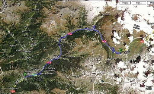
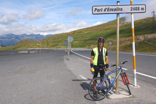
Climb: Port D’Envalira (2408m), the highest paved pass in the Pyrenees
Andorra la Viella, 1029m – Port d’Envalira, 2408m
[1,379m – 28,5 km – 4,8%]
Distance & Time: 57,46 Km – 3:07
Time going up /down: 2:19 – 0:48
Average speed up /down: 12,44 km/h – 35,91 Km/h
Max. speed and max. gradient for 1k: 67,6 Km/h – 9%
Conditions: No wind (if any favorable to climb)
Pace: Always below my limit
Description
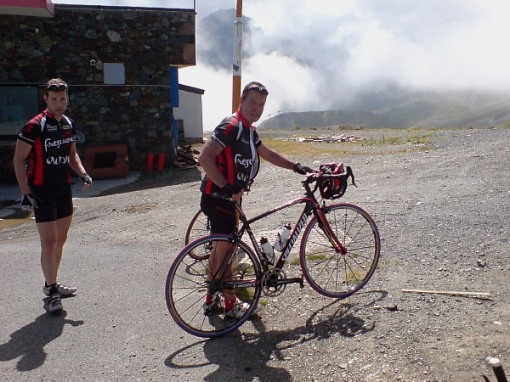
I have started this climb from the Valira camping site situated in Andora la Viella. The climb started steep but soon turned into a steady and easy climb. The road develops through the bottom part of a valley that though getting higher and higher very rarely gives the climber the opportunity to fear the next climb or to contemplate his climbing achievements due to the limited visibility. Around the 9thKm you get a first test. There you really feel going up with an ascent of 9% (climbing 90m in “just” 1 Km) the sun exposure and the distance to the top (about 20Km) took the cruising smile out of my face. The scenery is not one of a mountain climb, once you keep passing villages and seeing people walking around and also because you keep riding in the lower part of this valley until you are more or less 10 Km from the top. After passing the last village (Soldeu) you finally get the feeling you are climbing a mountain. At that point I was undertaken by a cyclist with a different bike (and level) and a second one (probably age 50s) was preparing to do the same. At that time I said to myself the youngster it’s ok but the senior not. And after a final push I made it to the top between these two. After a small chat with these nice guys I’ve discovered that they started this climb 60km before me and, after this almost 30km climb, still had 50km to finish. Respect.
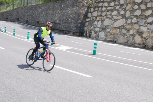
The descent was done going back and it was fun! Good asphalt and not very hard on the brakes. The wind though was not helping, I had to cycle all the way in order not to be too stressed about the bus driver that came behind.
Notes
Climbing this mountain from the Andorra la Viella side in the morning seems to have less cars but also a less mountain feel. Next time I want to do it from the other side (Ax les Thermes) but will probably leave around 6 am!
Links
http://www.climbbybike.com/climb.asp?Col=Port-dEnvalira&qryMountainID=3939
http://fr.wikipedia.org/wiki/Port_d’Envalira
http://search.pbase.com/search?q=port+d%27envalira&c=sp
http://cycloclimbing.com/pyrpass1500paved/index.html
Map & Photos
Photos captured by Cristiana Matos
—————————————————————————————–
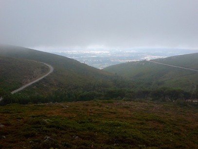
Serra de Montejunto (649m)
Climbing injuries suck!
Wile watching the Tour de France I just realised that I could still climb without using my fingers!
This idea occurred when the eurosport commentator called Alberto Contador a good climber…
Climber? Wait a minute, did you just say climber?! Brilliant I can still climb! !
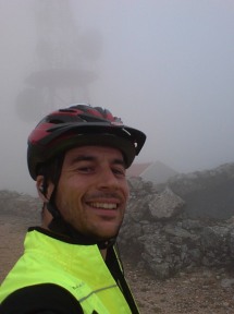
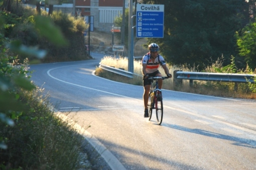
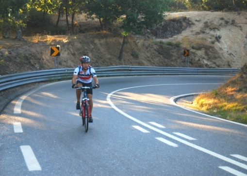
Preparing for bigger climbs in the Pyrenees and in the Alps this August:
Great vacations for everyone
Greetings




Leave a comment